Followers

Friday, September 21, 2007

Mon, Oct 1st - Capitol Reef National Park

Now here's our view out the front of the coach at the Torrey Campground!
Today a lot of us drove to the Capitol Reef National Park close by. We stopped into the Visitor Center and watched a video about the Park. While there, we took a group photo of five of the couples attending our Discovery Rally. See below.


Bill & Judy Wagner, Judy Wittenberg, myself & Chuck, Betty & Jr. Mertz, John Wittenberg, and new members from Virginia, Violet & Bob Radd (they only live about 30 miles from us in Warrenton, VA and we had to come all this way to get to meet them!)

Below are some of the rock formations that we saw. Several of us took a short hike into one of the canyons called the "Grand Wash" where we saw some unusual rock formations. It's amazing just how many different rock formations and colors there are in just this 12-1/2 mile stretch of road!


These rocks look like gigantic pieces of chocolate!

Here's part of the Scenic drive into the park.


Aren't these weird formations in this rock? Some were like seats and each couple sat in them and we took their picture!


What a sky! This area is called "Capitol Gorge." Kind of looks like the capitol building in Washington, DC, hugh?

This evening we had a wonderful meal cooked by the folks that run the campground! Chuck had a huge ribeye steak and I had ribs along with salad, potatoes, baked beans and scones with honey butter! Oh and ice cream and cookie for desert. We had enough steak and ribs leftover to have for dinner the next night!

Grandkids and Nephew Mason:

What are pictographs and petroglyphs and what did they depict? (When we get to Moab, we hope to take some pictures to show you.


Pictographs are painted pictures on rock surfaces and petroglyphs are carved or pecked pictures. They both are pictures of people, animals and other shapes and forms left on rock surfaces.

Capitol Reef: www.nps.gov/care

Sun, Sep 30th - Travel from Bryce Canyon to Torrey, UT

It got down to 23 degs F last night and everyone had unhooked their water hoses and brought in anything that would freeze from their coach basements. Today we drove in small groups of 2 or 3 coaches up Scenic Hwy 12 to Rt 24 to Thousand Lakes RV Park in Torrey, UT.


Irrigation is the main reason there is green grass in the valleys here in Utah! They seem to be spouting water somewhere all the time. Because it was so cold this morning, the water was making ice on the grass in many places.


This is such an unusual rock coloration with the stripes of brown in it.


Here's where the road got kind of curvy!


We followed this river bed for many miles and even saw some horses down in it out on the open range.


Out the front window of the coach. We were climbing up the side of a mountain with dropoffs on the drivers side and then we got to a place, which I think was called the Devil's Backbone, where the dropoffs were on both sides of the road as we rode along the top ridge of the mountain. It was kind of scary and I didn't get any pictures of that area!


After getting back into the forested area, we drove by an area that had these lava rocks!


Here we are heading down the mountain into Boulder, UT.


We have great fast WiFi here in Torry, but no cell service. We have a beautiful view out the front window of the coach. Check out tomorrow's pictures of the view!

Check out the pictures that I finally posted of the North Rim of the Grand Canyon, Mon, Sep 24th!


http://www.thousandlakesrvpark.com/ Thousand Lakes RV Park

Sat, Sep 29th - Bryce Canyon National Park

Today it didn’t get out of the 40’s—BURR—and the wind was gusting from 45 to 50 mph! No mule or horseback trail ride for us today! Our group of 3 couples drove back into Bryce Canyon to see more Hoodoo!

We drove to the end of the 18-mile Park road and started back, stopping at many of the overlooks where the men had to hold onto their hats and the ladies had ear muffs and gloves on or their jacket hoods up! Note the elevation in the picture above!


I think our favorite spot was the Natural Bridge formation above.


At a couple of overlooks, ravens greeted us as we parked the cars, looking for a handout. We got some good pictures of them.


And more Hoodoos!

Here's a neat single Hoodoo by itself.


This picture shows a trail that goes down around the Hoodoos. It's that light colored line about in the middle of the picture.

We had a late lunch at Fosters Steakhouse where I had a bowl of chili and a cup of hot chocolate and Chuck had a steak. After lunch, Judy, Judy and I did a little browsing at some nearby gift shops, while the guys went back to the coaches to watch football or the Busch NASCAR race. Needless to say, there was no Happy Hour this evening as everyone was “happier” staying warm in their coach. So I didn’t get a picture of that Stellar Jay! Maybe at the next campground. We did get together for a few minutes at 5:30 for a travel briefing for our trip up to Torrey tomorrow morning.

Did you know? An elderly Paiute named Indian Dick describes how Bryce Canyon was formed:

“Before there were any Indians, the Legend People lived in this place. They were of many kinds—birds, animals, lizards and such things—but they had the power to make themselves look like people. For some reason, the Legend People were bad, so Coyote turned them all into rocks. You can see them in that place now, all turned into rocks; some standing in rows, some sitting down, some holding onto others. You can see their faces with paint on them just as they were before they became rocks.”

Grandkids and Nephew Mason: I have gone back to some of the previous days and added some questions relevant to the Southwest Indians. I will go back and add some more as time permits and let you know which ones to go back and look at. I picked up the book, “101 Questions About Ancient Indians of the Southwest” by David Grant Noble, ISBN 1877856-87-8.

*I added some questions to Sat, Sep 15th--Mesa Verde.


www.brycecanyoncountry.com/bryce.html

Fri, Sep 28th - Travel from Glendale to Bryce Canyon, UT

Today we drove from Bauer’s Campground in Glendale to Ruby’s in Bryce, UT. Another beautiful sunny, blue-sky day and beautiful scenery. This drive took us north on hwy 89 to just south of Panguitch, where we turned east on Hwy 12 and drove thru Red Canyon with its beautiful red hoodoos. Panguitch is the Paiute Indian name for water or fish. After getting parked at the campground, we (Tolsons, Wittenbergs and Wagners) headed into the Park and stopped in the Visitor Center to watch the 20 min film about Bryce Canyon. The film mentioned “quaking” aspen trees, which I find a very fitting word to describe how they move in the wind. We picked up a few long-sleeve T-shirts so we can be walking advertisements for Bryce when we get back to Virginia! Being later in the afternoon, we just stopped at the Sunset Point lookout and walked “part way” down the Navajo Trail that meandered down thru the Hoodoos and then we walked along the rim back to Sunrise Point. Tomorrow we will go into the park again and do some more sightseeing.

We have seen several beautiful Stellar Jays, but never close enough to get a picture until tonight. We all got together for Happy Hour and then to finish up leftovers of sandwich meats, salads, etc. and then sat around the fire to get warm—it was earmuffs and gloves CHILLY! A Stellar Jay flew in and stayed close by for a long time to see if he could get a handout. Of course he did. I didn’t have my camera, but I’ll take it tomorrow evening to see if he comes back.


Here's the view of Hoodoos from Sunset Point.


And here are John & Judy Wittenberg, Bill & Judy Wagner and Chuck & I.

If you look on the bottom right of this picture, you will see part of the Navajo Trail at Sunset Point. No we did not walk it all! It was quite a steep incline going down and then coming back up to the top and meandered in and out of the Hoodoos all the way over to Sunrise Point.


For the Grandkids and Nephew Mason: What is a Hoodoo?

Hoodoos–a pinnacle or other odd-shaped rock left standing by the forces of erosion. Hoodoo—to cast a spell. From voodoo: something which causes bad luck.

The colors at Bryce are the result of oxidized minerals—red, pink and orange from iron; purple from manganese. The whites are purer limestone.

Bryce’s climate is ideal for hoodoos. With freezing temperatures more than 200 days a year, a relentless cycle of freezing and thawing widens cracks in the cliffs. Runoff scours away the frost-wedged debris and cuts, narrow gullies between walls, eventually isolating pinnacles and exposing them to even more weathering.

To grasp the hoodoo’s giant scale and for closer views of hoodoos-in-the-making, take a short hike down among them on either the Queens Garden or Navajo Trails. In spring listen to Bryce Canyon eroding. Small pebbles bounce down as the sun warms the slopes. Large rockfalls usually occur at night, when they are not often seen or heard.

The Paiute Indians, who lived in the Bryce Canyon region when settlers and other people from the eastern states came to southern Utah, accounted for the hoodoos as the “Legend People” whom Coyote had turned to stone.” We have seen many large ravens and you can understand how they played such a part in Indian culture along with the coyotes.


www.nps.gov/brca Bryce Canyon National Park
http://www.scenicbyway12.com/ Hwy 12 is the road we traveled over to get to Bryce and will continue on to get to Torry, UT tomorrow, Sunday.
http://www.accessgenealogy.com/native/tribes/paiute/paiutehistory.htm Paiute Indian History

Thu, Sep 27th - Cedar Breaks National Monument & Cookout

Today we drove over to Cedar City with the Wittenbergs and the Wagners to enjoy the scenic view along Hwy 14, to stock up at Wal-Mart, have lunch and then visit the Cedar Breaks National Monument on the way back.


There were lots of "HooDoos" here at Cedar Break and it was very cold and there was a little snow on the ground.


Here's the chicken!

The Bauer family (our campground hosts) cooked us dinner in large kettles using hot coals--chicken, potatoes with onions and bacon, baked beans, salad and peach cobbler, also cooked in a skillet over coals.


Here we all are enjoying the good eats!


After dinner, Mr. and Mrs. Bauer entertained us with local stores--true and the "pull-your-leg" kind! Tomorrow we round 'em up and head out to Rubys Inn and RV Park in Bryce Canyon, UT--no internet, I think!

Wed, Sep 26th - Glen Canyon Dam and Lake Powell

Today we went south to the Glen Canyon Dam and Lake Powell near Page, AZ with the Wittenbergs, Wagners and Mertz. We took a 45-minute tour of the Dam, which was very informative. We met a young couple (in their 20s) from Israel that were on our tour and got to talk to them about their country and how they liked ours. Very interesting! We had lunch at the Pizza Hut in Page and then drove down to one of the marinas and campgrounds at Lake Powell. What a beautiful lake! Of course, today ended with Happy Hour and then a campfire with "Discovery" friends.

Bridge across the chasm that goes into Page, AZ.


View of the dam and part of the visitor center. We had to go thru security like going on an airplane except we couldn't take any purses inside. They had very sensitive metal detectors and several of us had to be gone over with a wand.

Here's a picture of the Visitor Center, which is built out over the dam for better viewing.

Here's one of the cement buckets that they used to make the dam and our very informative tour guide, Rachel.


Here are the turbine generators that make the electricity.


And here's a picture of beautiful Lake Powell. We saw many houseboats and power boats on the lake. There is a beautiful campground there too by one of the marinas.


www.lakepowell.com/ Lake Powell

www.desertusa.com/gc/gcd/du_glencaydam.html Glen Canyon Dam

Tue, Sep 25th - Zion & Discovery Rally Begins

Today was a much warmer one at Zion National Park and not so far to drive from the campground. It got up to 81 deg down in the valley between all of the huge rock formations. You had to lean way back to be able to look up at the top of the rocks! It was almost impossible to get a ground to sky picture from our vantage points.

We spent the day with two other Discovery couples, John and Judy Wittenberg (IL) and Bill and Judy Wagner (KY). Chuck took picture. Note the large opening in the rock directly above my head--that is a window in the long tunnel that we drove thru.


This is called the "Checkerboard Mesa" and was a very unusual rock formation.


You drive thru part of the park and the other part you ride on a shuttle bus like the one above, getting on and off throughout the park. We went to the visitor center first and saw a film about the park, which got us orientated as to what we wanted to stop and see.


We had lunch on the patio of the lodge and this was our view.

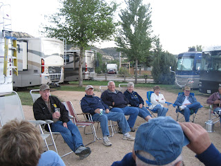
That evening after Happy Hour and a light dinner, the Discovery Club members all gathered around a fire to talk about what everyone did today.

www.zionpark.com/index.htm

Mon, Sep 24th - North Rim of Grand Canyon

Some of our Discovery friends pulled in last night and today, so we are busy catching up with old friends and making some new ones. It's going to be harder and harder to keep up this blog with so many things to do now and so many friends to visit with! But I will try!!

We left the campground early this a.m. and Chuck had to scrape the ice off the windshield of the Vue. It got down to 34 deg last night and it didn't get above 49 deg at the North Rim of the Grand Canyon all day, though the sun was out bright and it didn't feel that cold. We drove thru some very diverse terrain--first red rock canyons, then a few small towns (Orderville, Mt. Carmel Junction and Kanab in UT and speed-trap Fredonia in AZ), then high desert that was covered with sage brush, up into a forested area with lots of burnt pine trees, then thru beautiful meadows with yellow aspen trees and then into the north rim area with pine forests and burnt areas with new yellow aspen everywhere. They had several "Controlled Fires" at one place in the park that were still smoldering. We took SOOO many photos, but I'll try to just post a few. We did get to see two tassel-eared Kaibab squirrels, also known as the "Silver ghost of the Forest", but they were too fast to get a picture of them. They look like an ordinary grey squirrel, EXCEPT their tails are snow white! To see a picture of this squirrel, go to: http://en.wikipedia.org/wiki/Kaibab_Squirrel .


Here's the red rock canyon we drove thru before we got to Kanab.


And here's the high desert covered with sagebrush.


And then we drove thru a forest of pine trees that were burnt in a forest fire a few years back. They had cleared the ones closest to the road and they were all stacked in piles. It must have been quite a fire as acres and acres of trees were burnt.


And then there were beautiful meadows along the road just before we entered the Park.

Here's the lodge at the North Rim of the Grand Canyon where we had lunch "with a view." Our table was in front of the window on the far left of the building.


Here's one of the lookouts that we walked out on at the lodge area.


This picture is of Angels Window. We walked out to the end of this point above the window for a great view.


After they do a "controlled burn" in the Park, the first trees to come back are Aspen. They were a beautiful yellow color.


This is a picture taken from Point Imperial. The land at the top of the picture is the Navajo Indian Reservation. We will be going there later in our trip.


Later in the day as we left the Park, the animals were coming out into the meadows as this mule deer above did.


There were about 15 wild turkeys beside the road and then they decided to cross it!

Of course the day ended with "Happy Hour" and visiting with our Discovery Club friends.